If you start at our house, and drive away from the city, it takes you about 20 minutes to get to the other (non-city, non-harbour) side of the coast. The closest part of this coastline to us is Makara Beach. We'd gone there once before, but it was a dreary day and we were wearing beach shoes, so when we discovered that we'd probably need to do some hiking before finding a good stretch of beach, we promptly gave up.
However, I did put a little reminder note in the back of my mind that Makara Beach deserved further exploration. J wasn't as interested, so I headed there myself on one of the days when I was still on summer holiday and he'd gone back to work.
I took a lot of pictures during my 3 1/2 hour hike/meandering stroll. Usually, I then delete the majority of them, but these ones were just fabulous, and I couldn't resist posting most of them.

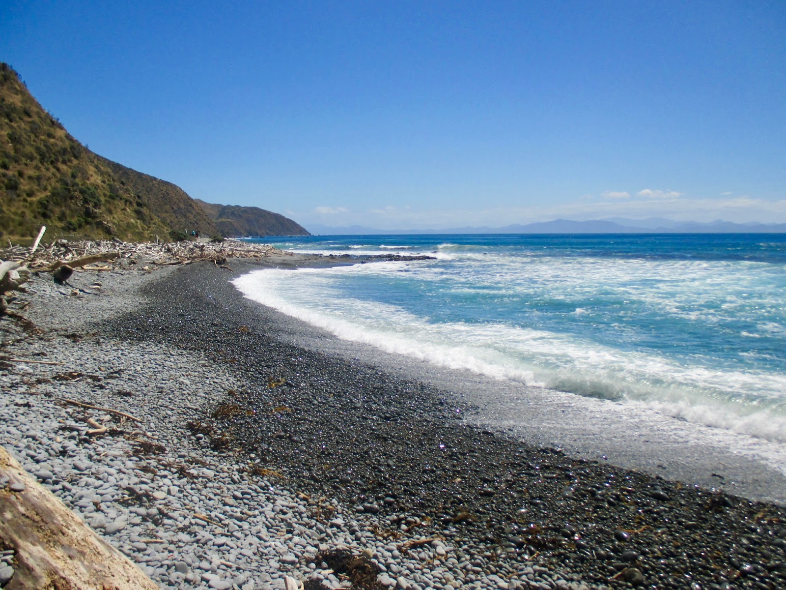
The first part of the beach you see was already far more impressive simply by virtue of it being a sunny day. The colours of the water were mesmerizing, unlike on cloudy days when the ocean is usually just blue-grey. Unfortunately, that first part of the beach still has an unpleasant smell hanging about, so I headed strait up the hills on a path that said it would take me to Opau Bay.

I'm thinking that that island must be Mana Island. I would have thought that it would be too far around the coastline to see from there, but given that the maps show no other islands in that area at all, I'm inclined to conclude that must be it.

This is looking back at Makara Beach from halfway up the first hill. Notice the wind turbines on the hills.

We hadn't had much rain in the preceding weeks, so the grasses were fairly dry and yellow-brown, as compared to NZ's typical vivid green, but still beautiful.
I think that the second curve inland, that you can't see the end of, is Opau Bay, to which I walked.

In many of these pictures from up high, you can see the beach that I then walked back on, completing my circuit.

There are amazing views of the South Island! How many shades of blue can you have in one picture?
Those hills, as far as I can figure out, are Arapawa Island in front and Cape Jackson in the back.

There is lots of driftwood along parts of the beach (and none along others).

This is a different group of wind turbines. I know some people don't like them, but even aside from my enthusiasm for wind energy, I think they're lovely to look at.
If I remember right, this is the view from near where I rejoined the beach from the inland trails at Opau Bay.
What a lovely, rocky beach! I love the stark contrast between the colour of the wet and dry stones.

I actually took this picture because the way the sun lights up the waves makes me think of the ocean character in Moana, but then later I noticed that it's cool to have the South Island in the background as well.

I discovered on my way back that not far from the start of Makara Beach, there is a section where there no actual beach, just huge volcanic rocks. You have to clamber over quite a few of them, which was quite entertaining, and also hopefully keeps lazy, disruptive people off the rest of the beach.

I love watching the spray as the waves hit the rocks.
I am so happy that I have Makara Beach another try, because it is now one of my favourite beach walks I've done so far. I will definitely be doing it again and again! And be forewarned, if you come to visit, I'll want to take you there.
Really beautiful pics, it's not far from Welly, I should go there one day :)
ReplyDeleteHow far is the south island from the north? They seem close from the pictures. Is there a lava god in new Zealand? Hawaii ' s is Pele. It's so neat to see the south island in your pictures! The pictures you take are always beautiful. These are no exception. Thank you for your blog!
ReplyDelete